The closest national park to Arusha town – northern Tanzania’s safari capital – Arusha National Park is a multi-faceted jewel, often overlooked by safarigoers, despite offering the opportunity to explore a beguiling diversity of habitats within a few hours.
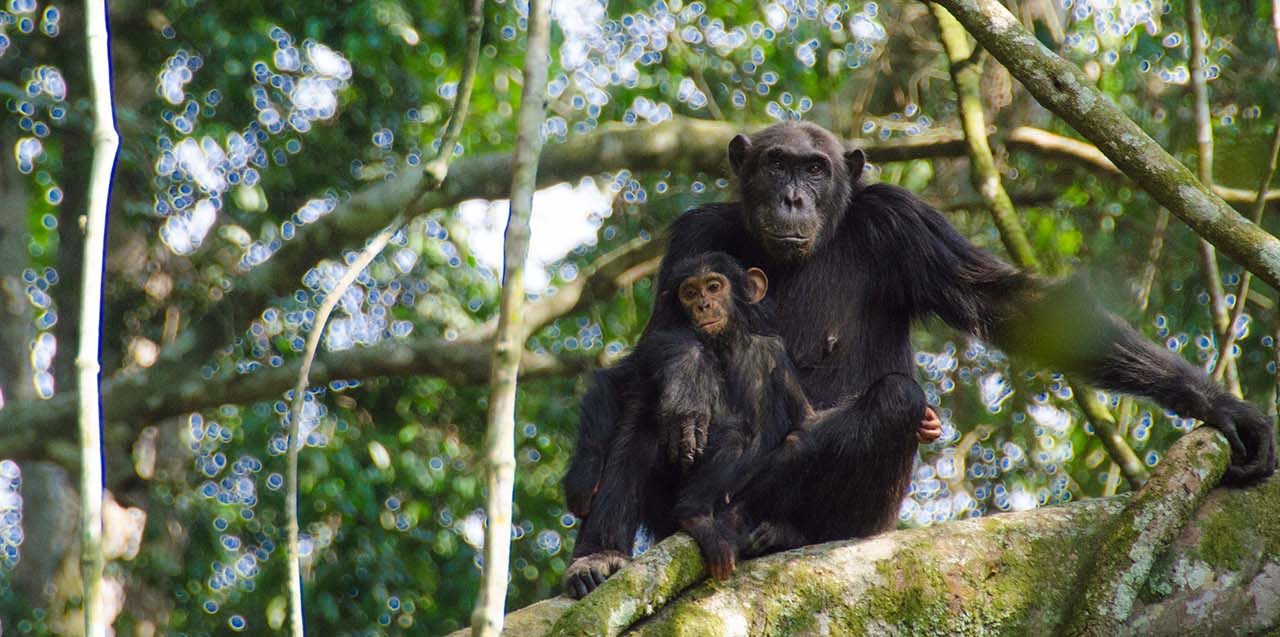
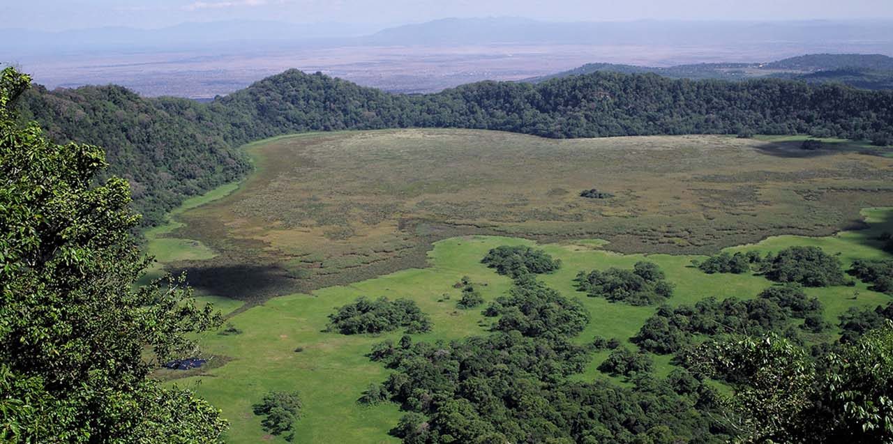
The entrance gate leads into shadowy montane forest inhabited by inquisitive blue monkeys and colourful turacos and trogons – the only place on the northern safari circuit where the acrobatic black-and-white colobus monkey is easily seen. In the midst of the forest stands the spectacular Ngurdoto Crater, whose steep, rocky cliffs enclose a wide marshy floor dotted with herds of buffalo and warthog.
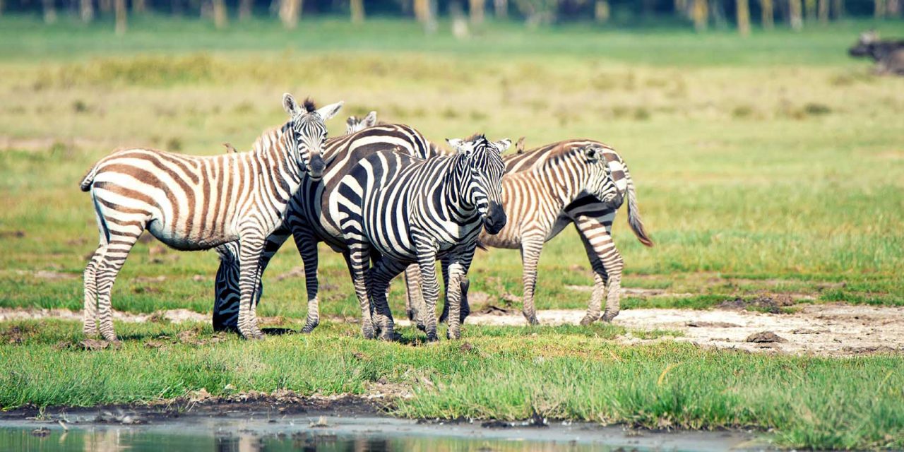
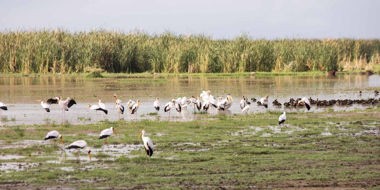
Further north, rolling grassy hills enclose the tranquil beauty of the Momela Lakes, each one a different hue of green or blue. Their shallows sometimes tinged pink with thousands of flamingos, the lakes support a rich selection of resident and migrant waterfowl, and shaggy waterbucks display their large lyre-shaped horns on the watery fringes. Giraffes glide across the grassy hills, between grazing zebra herds, while pairs of wide-eyed dik-dik dart into scrubby bush like overgrown hares on spindly legs.
Although elephants are uncommon in Arusha National Park, and lions absent altogether, leopards and spotted hyenas may be seen slinking around in the early morning and late afternoon. It is also at dusk and dawn that the veil of cloud on the eastern horizon is most likely to clear, revealing the majestic snow-capped peaks of Kilimanjaro, only 50km (30 miles) distant.
But it is Kilimanjaro’s unassuming cousin, Mount Meru – the fifth highest in Africa at 4,566 metres (14,990 feet) – that dominates the park’s horizon. Its peaks and eastern footslopes protected within the national park, Meru offers unparalleled views of its famous neighbour, while also forming a rewarding hiking destination in its own right.
Passing first through wooded savannah where buffalos and giraffes are frequently encountered, the ascent of Meru leads into forests aflame with red-hot pokers and dripping with Spanish moss, before reaching high open heath spiked with giant lobelias. Everlasting flowers cling to the alpine desert, as delicately-hoofed klipspringers mark the hike’s progress. Astride the craggy summit, Kilimanjaro stands unveiled, blushing in the sunrise.
About Arusha National Park
Size: 552 sq km 212 sq miles).
Location: Northern Tanzania, northeast of Arusha town..
Getting there
An easy 40-minute drive from Arusha. Approximately 60 km (35 miles) from Kilimanjaro International Airport. The lakes, forest and Ngurdoto Crater can all be visited in the course of a half-day outing at the beginning or end of an extended northern safari.
NOTE: Mountain Climbing Permits duration time is 12 HOURS.
What to do
Forest walks, numerous picnic sites;
three- or four-day Mt Meru climb – good acclimatisation for Kilimanjaro.
When to go
To climb Mt Meru, June-February although it may rain in November.
Best views of Kilimanjaro December-February.
Accommodation
Two lodges, two rest houses, camp sites, two mountain huts inside the park; more lodges at Usa River outside the park and many hotels and hostels in Arusha town.